
Avalanche Canada – Storm Warning
Conditions leading up to and through the weekend of December 19, 20 look stormy. But timing is everything. Read on to learn more about how storms will affect the avalanche hazard in your area this weekend.
Successive storms
A parade of moderate-sized storms has passed through much of western Canada this week, steadily adding new snow to the winter snowpack. The weather gods have saved the juiciest storms for the weekend, so batten down the hatches and prepare for a wild ride of snow, rain and wind, and—of course—high avalanche danger.
Friday, Saturday or Sunday?
Depending where you live, the apex of the storm will arrive at different times.
First up will be the South Coast. If you live in Vancouver and you like to recreate in the North Shore Mountains, you’ll need to start paying attention on Friday. Expect worsening conditions through the day with danger likely to move into the red towards the end of the day once sufficient snow has fallen and temperatures start to rise.
Up on Saturday will be Northwest Coastal areas and high-snow parts of the North Rockies. Places like the Shames backcountry, Pine Pass and areas east of Prince George, like the Torpy look likely to see sufficient snow for a natural avalanche cycle to start at some point on Saturday. Oh, and the South Coast region is expected to get a second bonus storm, because—well—two storms must be better than one. Saturday’s storm looks like it will pack even more of a punch than the one on Friday.
On Sunday, the focus turns to inland sections, including the Cascades, North and South Columbias and the Lizard/Flathead Range. Places like the Coquihalla, Whistler, Sicamous, Blue River, Revelstoke and Fernie are likely to be the hot-spots, but other communities could see locally heavy amounts too. Also, freezing levels are expected to rise during the storm, turning the snow to rain in some parts and adding further to the avalanche danger.
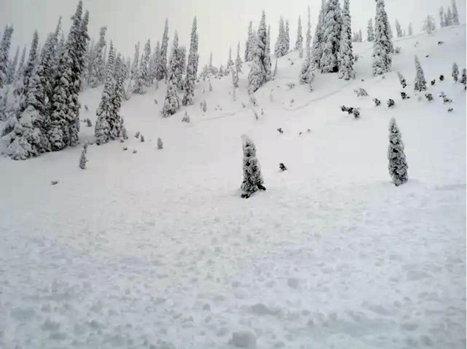
Small avalanches like this one were noted from the South Coast and parts of the Columbias earlier in the week. As storm snow amounts continues to increase, so too does the expected avalanche size. Image: TANNER ROSS
Check the forecasts for details
The basic pattern is quite similar, snow accompanied by wind and rising temperatures. The difference is in the timing and to some extent the intensity of the storm. There are differences in how high freezing levels will go too. For a more detailed assessment and daily updates, make sure to check the individual forecasts that apply to your area before making your weekend plans.
What to do when the danger is High
Navigating around the mountains safely during high avalanche danger is an advanced skill. Unless you have professional-level avalanche training, the basic recommendation is to stay within the safety of a ski area boundary, or if you’re a sledder, stick to the groomed trail network. If you do venture further, stick to simple terrain that’s less than 30 degrees and is not threatened by avalanche paths from above. If you’re on skis or snowshoes, mature forests can offer good protection and give good options for high hazard days.
Please have fun but play it safe during these challenging times.
By: James Floyer and the AvCan forecast crew
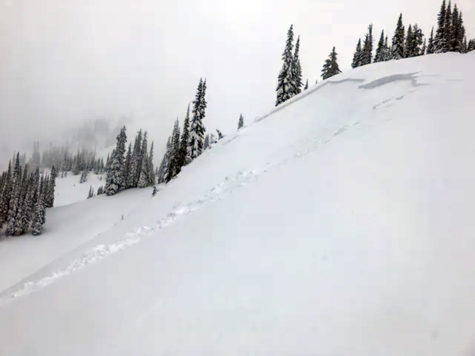
Navigating safely through the mountains under high avalanche danger is an advanced skill. This avalanche that occurred on Wednesday in the North Columbia mountains indicates wide propagation can be expected under current conditions. Large avalanches are likely with additional snow and rising temperatures this weekend. Image: JASON1AIREY


Comments