
Signs Point to Powder: La Niña Could Fire Up Western Canada
Signs point to powder this winter as the Pacific cools and long-range forecasts hint that La Niña is gearing up to make a comeback — a pattern that could spell deep snow and cold temps across Western Canada’s mountains.
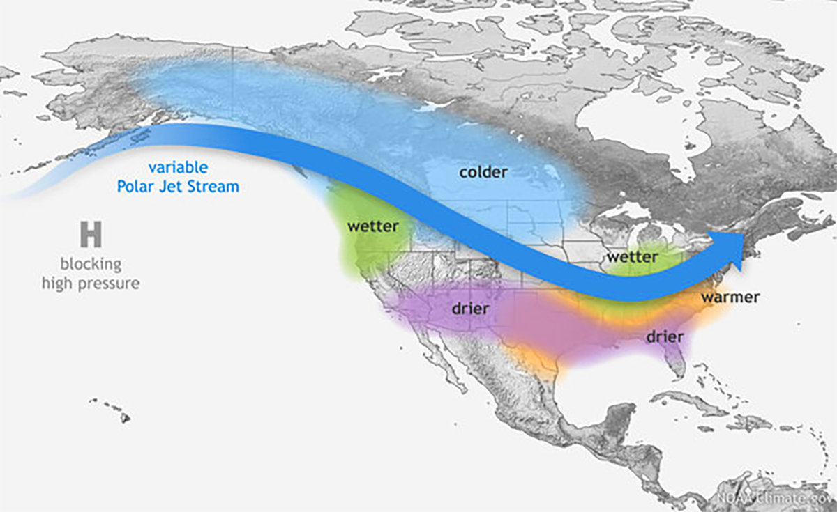
According to the latest NOAA and Environment Canada outlooks, the Pacific Ocean is trending back toward La Niña conditions. Forecasters now give it about a 70% chance of developing by late fall — a shift that could reshape weather across the West.
NOAA’s Climate Prediction Center reports that sea-surface temperatures are dropping and atmospheric patterns are lining up to support a weak La Niña through early 2026. That’s enough to steer the storm track right where we want it: across British Columbia and into the Rockies.
“Even a weak La Niña can bring colder, snowier conditions to Western Canada,” NOAA’s forecasters note. “It doesn’t have to be a strong event to tilt the odds toward powder.”
La Niña winters typically mean a southward shift in the jet stream, pulling cold Arctic air down across the Prairies and funneling Pacific moisture straight into Western Canada’s mountain ranges. The result: consistent storms, colder temperatures, and that perfect, blower-dry snow that defines Canadian skiing.
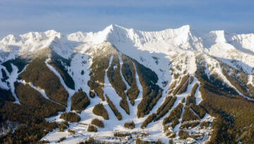
Whistler Blackcomb & the Coast Range: Early storms and cooler temperatures could bring a strong start to the season. When La Niña lines up, the Coast Mountains get deep.
The Powder Highway (Revelstoke, Kicking Horse, Whitewater, Fernie): Historically La Niña’s biggest beneficiaries. Expect frequent storm cycles and cold snow sticking around longer than usual.
The Rockies (Sunshine, Lake Louise, Marmot Basin): Colder air and dry powder potential increase as systems sweep eastward. The outlook points to a solid, cold midwinter for Alberta’s big resorts.
Interior BC & the Okanagan (Big White, SilverStar, Sun Peaks): Cooler temps and above-normal precipitation make for reliable base-building conditions and quality snowpack through January.
Meteorologists say this La Niña will likely be weak to moderate — not a monster, but plenty to influence our weather. Expect stretches of mild weather, but also prolonged cold snaps when the Arctic front locks in. Those are the weeks that make Western Canada legendary — and keep powder hounds glued to the forecast.
If the Pacific continues cooling and the jet stream holds its shape, January and February could deliver the kind of cold storms that define a classic La Niña year: light snow, deep days, and frosted eyelashes in the lift line.
The signals are stacking up. The Pacific is cooling. The jet stream is shifting. And Western Canada — from the Coast Mountains to the Rockies — is primed for another winter to remember.
So wax your boards, book your trips, and get ready.
If the forecasts hold, La Niña could deliver a vintage 2025–26 season across Western Canada.


Comments