
Signs Point to Powder: La Niña Could Deliver
As the summer heat lingers into August 2025, skiers and snowboarders are hopeful that La Niña could deliver. The question on everyone’s mind: will La Niña return to bless us with another powder-filled winter?
According to recent forecasts from NOAA and the International Research Institute (IRI), the odds are improving. Long-range climate models are trending toward a weak to moderate La Niña developing by late fall—an exciting prospect for northern resorts. NOAA’s North American Multi-Model Ensemble (NMME) and the IRI ENSO Plume Forecast both show cooling sea surface temperatures and rising La Niña probabilities heading into the 2025-2026 season.

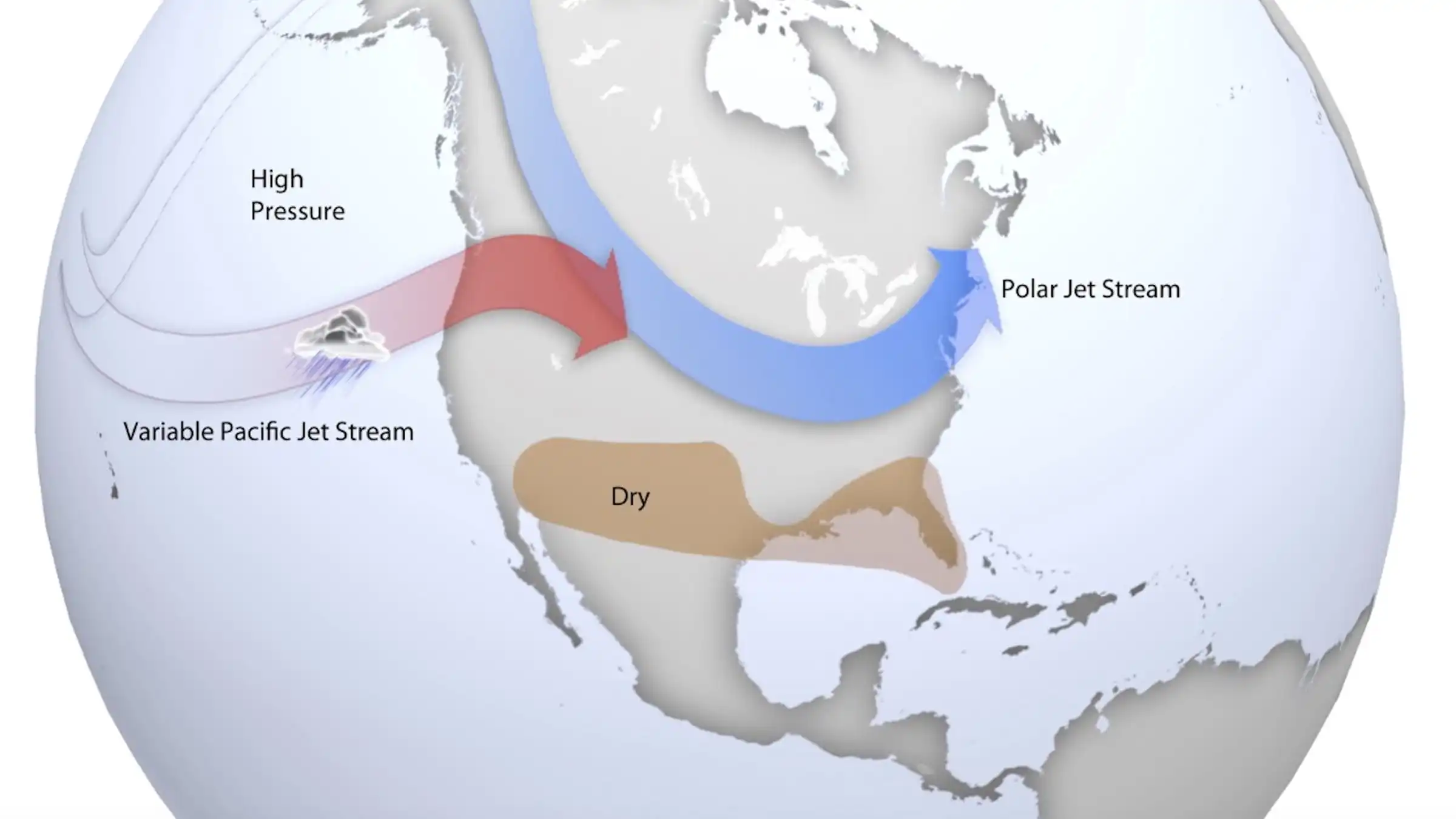
Why is this great news for skiers and riders? Historically, La Niña winters bring colder temperatures and above-average snowfall to key Canadian regions, especially the Pacific Northwest, the Northern Rockies, and parts of Eastern Canada. This means good things for major ski zones like Whistler, Fernie, Whitewater, Revelstoke, and even Mont Tremblant in the East.
With the polar jet stream expected to shift southward, the setup is primed to funnel cold Arctic air across the country, enhancing storm tracks and dumping snow on our most beloved resorts. If early indicators hold, January 2026 could bring prolonged cold spells and deep powder days thanks to a potentially weakened polar vortex—a pattern often amplified during La Niña phases.
While the ENSO system remains officially “neutral” for now, the signs are promising. The Pacific is cooling. The jet stream is shifting. And Canadian skiers might just be in for another banner powder season!
Stay tuned, get your pass, wax your boards, and keep your eye on the forecast—Winter 2025-2026 is shaping up to be one to remember.


Comments